
- 1855: 45 miles completed from Chicago to the Illinois State Line by the Chicago and Milwaukee Railroad
- 1855: 40 miles completed from Illinois State Line to Milwaukee, Wisconsin by the Green Bay, Milwaukee & Chicago Railroad
- 1857: GBM&C acquired by the Milwaukee and Chicago Railroad
- 1863: M&C and C&M become part of the Chicago and Milwaukee Railway
- 1881: C&M acquired by the Chicago, Milwaukee & North Western Railway
- 1882: Second track constructed from Chicago to Evanston
- 1883: CM&NW acquired by the Chicago & North Western Railway
- 1888-1895: Second track constructed from Evanston to Milwaukee
- 1898: Third track constructed from Chicago to Rose Hill and track elevated
- 1910: Third track constructed from Rose Hill to Wilmette and track elevated
- 1911: Realignment in Chicago for new station
- 1966: National Avenue (Milwaukee)-Capitol Drive segment abandoned
- 1981: Third track removed from Chicago to Wilmette
- 1981: Metra begins operations between Chicago and Kenosha as the Union Pacific North Line
- 1987: Second track removed from Kenosha to National Avenue
- 1995: Chicago & North Western purchased by Union Pacific Railroad
- 2009: Wiscona-Capitol Drive segment abandoned, acquired for trail use
- 1984-Present: Metra operates the Union Pacific North Line from Chicago to Kenosha
- 1995-Present: Union Pacific operates the Kenosha Subdivision from Chicago to National Avenue
- 2014-Present: Oak Leaf Trail runs between Milwaukee and Wiscona
06/26/21
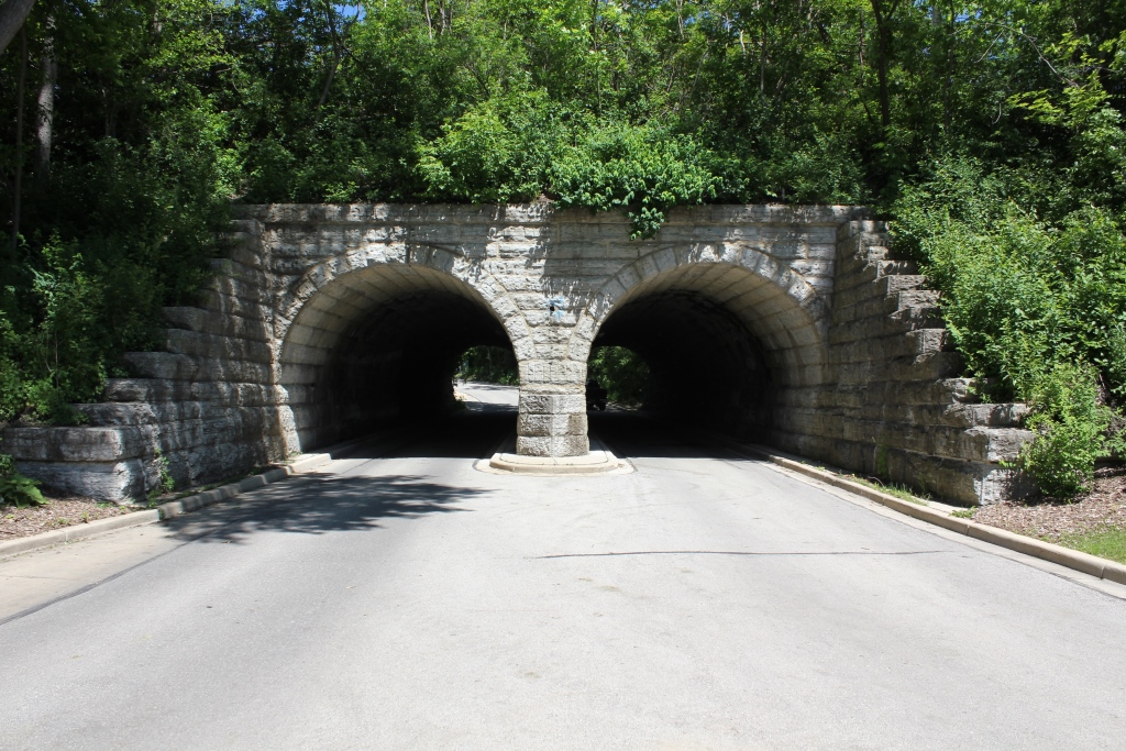
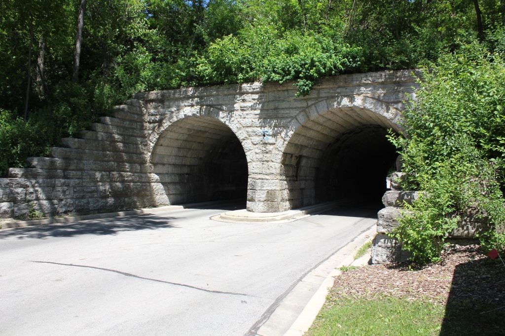
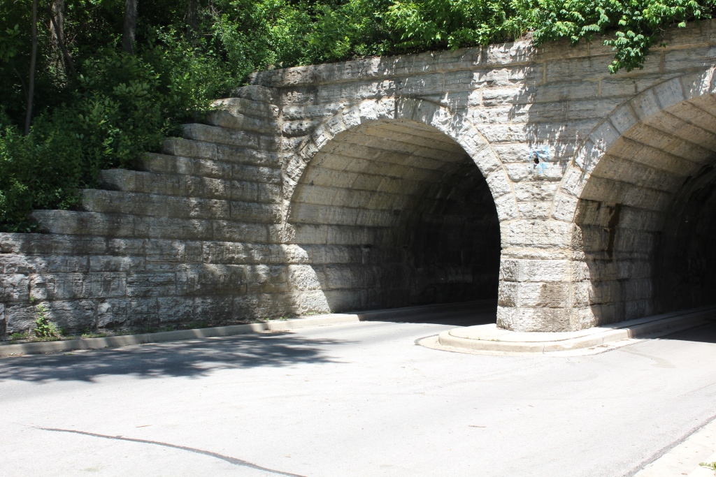
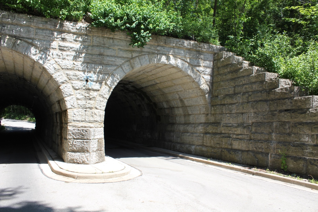
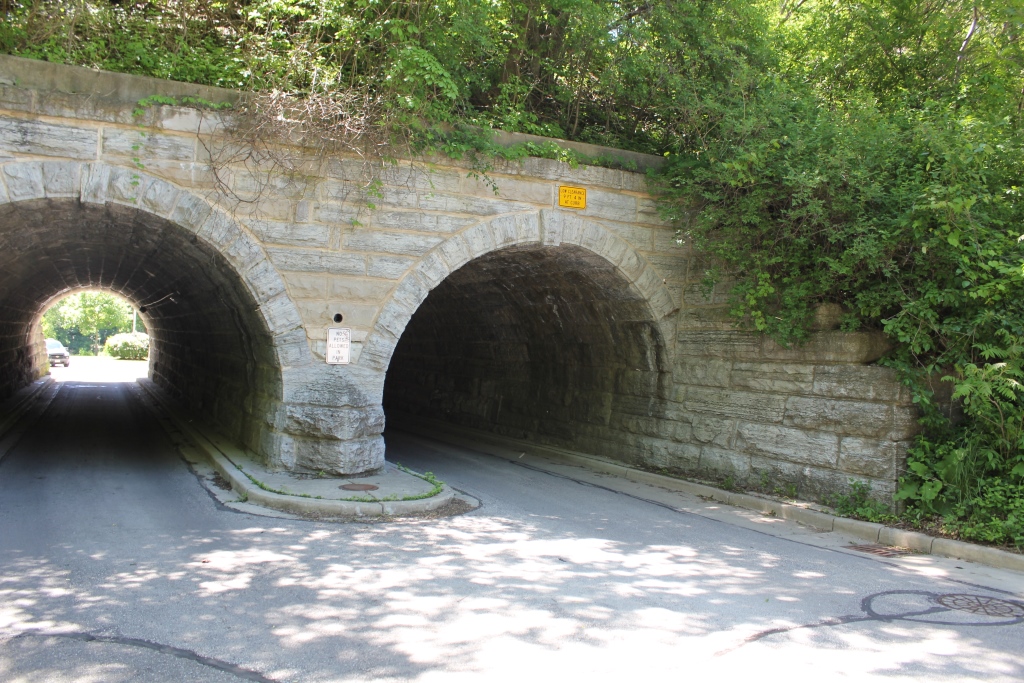
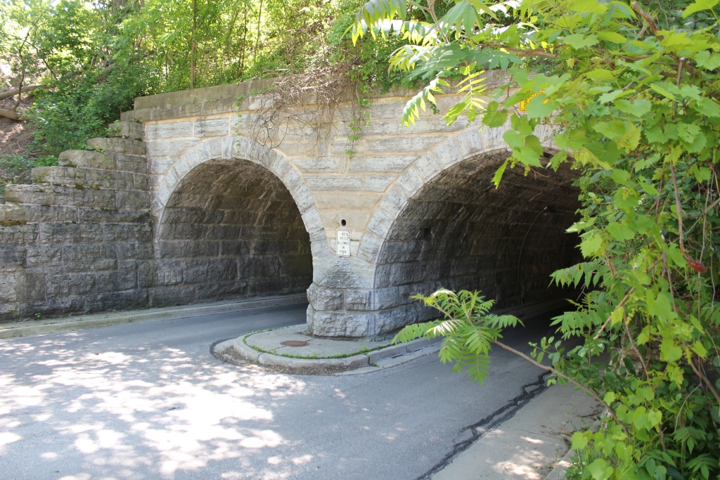
This stone arch is a noted bridge in the area, and serves as the entrance to the riverfront area of Hubbard Park, along the Milwaukee River.
Wisconsin Department of Transportation did a historic bridge narrative in 1984, which is presented below.
Written by Jeffrey A. Hess as part of the 1986 Wisconsin DOT Historic Bridge Project:
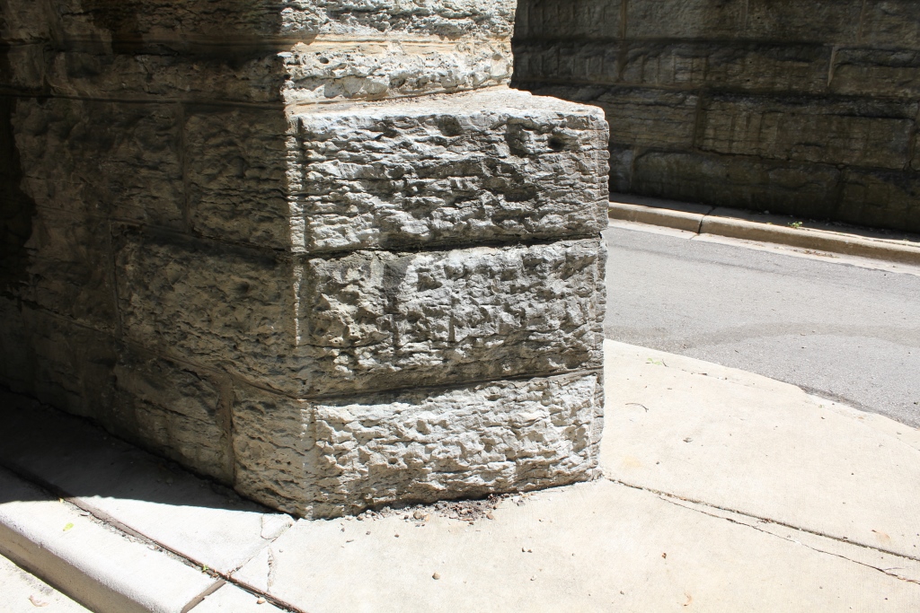
The structure is a rock-faced, coursed-ashler, sandstone bridge with 2 semicircular arches, perpendicular wing walls, and ornamental, triangular cutwaters on both faces of the central pier. Springing about 5 ft. above grade, the arches rise 7 ft. 6 inches over spans of 15 ft. Differences in stonework on the east and west elevations suggest that the bridge has been widened. The east elevation displays ring stones with a smooth, chamfered margin on the bottom edge; the keystone is elongated. In contrast, the west elevation makes no distinction between the keystone and the other ring stones, which are chamfered with a smooth margin on the intrados. The bridge's length, excluding wing walls, is about 24 ft.; its width about 97 ft. Although the bridge's width is sufficient to have accommodate multiple tracks, it now carries a single track, bordered on the east by a pedestrian walkway. [Note: The track is now gone, the right-of-way has been converted to a bike trail.]
Constructed by the Milwaukee, Lake Shore and Western Railway Company, the bridge embodies a standard stone-arch plan favored by many American railroads during the last quarter of the nineteenth century. There are seven similar, stone-arch highway crossings in Wisconsin built by the Chicago & North Western [sic] Railway. The Milwaukee, Lake Shore and Western bridge differes from these primarily in its use of ornamental cutwaters and perpendicular (instead of flared) wing walls. These features make the design a significant, and architecturally interesting, variant of the standard, stone-arch, railroad bridge.
[Note: This document was prepared by Jeffrey A. Hess and Robert M. Frame III for the Wisconsin DOT. It is part of a project that was launched by the Wisconsin DOT in conjunction with the Federal Highway Administration. It was published by the Wisconsin DOT in 1986, in a report entitled Historic Highway Bridges in Wisconsin, Volume 1, on pages 103-108.]
Valuation documents give dates of 1892 and 1904 on this bridge, which is not quite as old as other bridges in the area.
Regardless, the bridge is one of two double stone arches in Milwaukee County, the Other being in South Milwaukee, and built in 1883 and widened in 1890.
The bridge was also reportedly used as an underpass during ice harvesting from the Milwaukee River.
The author has ranked this bridge as being moderately significant, due to the double arch design.
The photo above is an overview. The bridge can be accessed from the road below.